"This_means_something._This_is_important"_(19967592275).jpg
Summary
| Description |
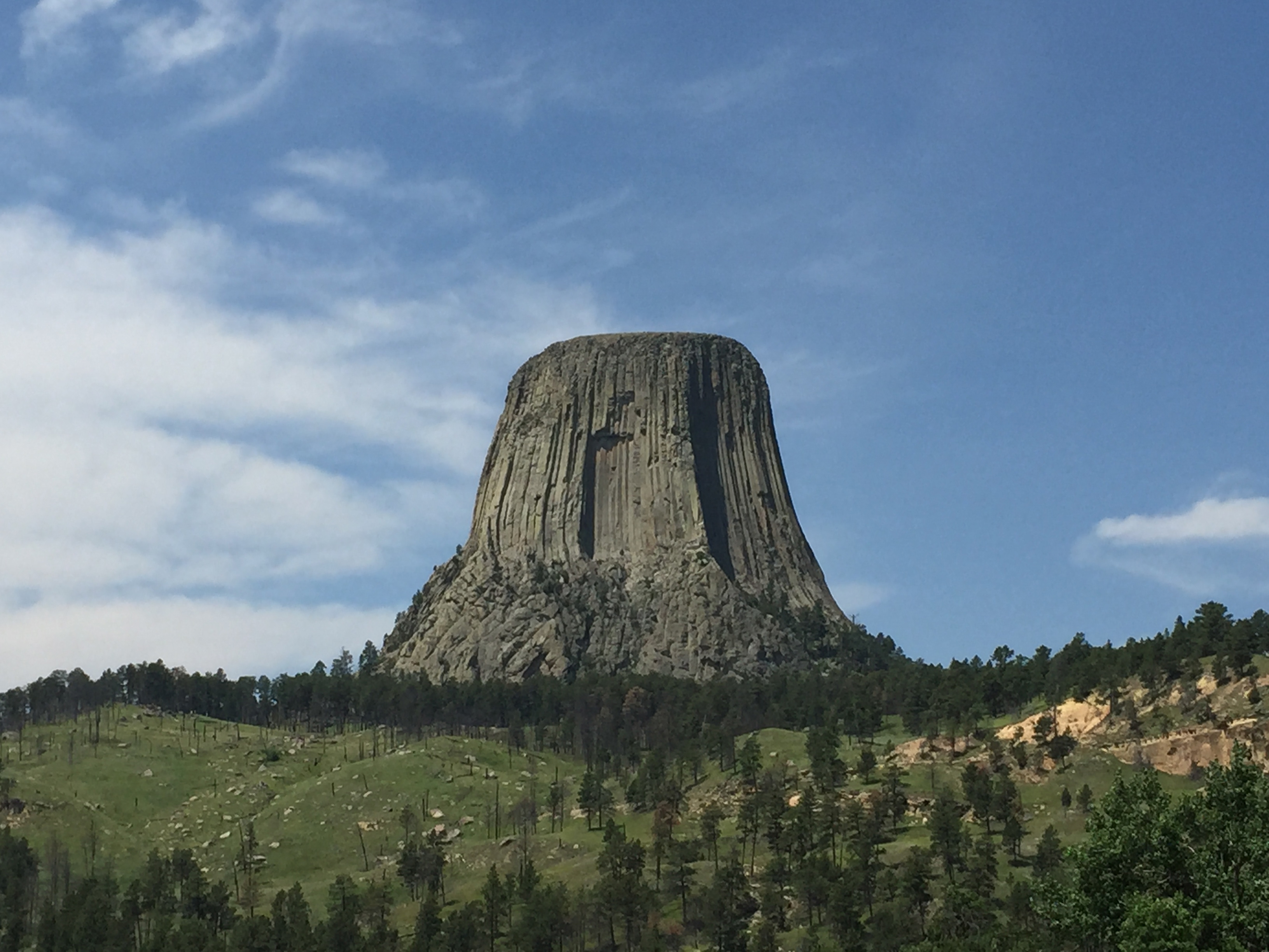
"This means something. This is important." — If you're familiar with that famous movie line from "Close Encounters of the Third Kind" then you'll remember Richard Dreyfus carving a vision of something out of mashed potatoes. The vision, of course, was Devils Tower. While this isn't a shot of a well-sculpted potato heap, it's definitely the real Devils Tower in Wyoming. Devils Tower is an eroded laccolith in the Black Hills of Wyoming. A laccolith forms when molten magma forces its way into a rock formation, then cools and hardens. As the surrounding rock erodes away over time, the hardened former magma remains. The streaked surface of Devils Tower reflects the polygonal shaped fractures (columnar joints) that formed as magma contracted as it cooled and hardened. Devils Tower rises 1,267 feet above the nearby Belle Fourche River and according to the National Park Service, the summit is roughly the size of a football field. Photo credit: Alex Demas, USGS. You can learn more about Devils Tower National Monument at: www.nps.gov/deto/ . |
| Date | |
| Source | "This means something. This is important" |
| Author | U.S. Geological Survey from Reston, VA, USA |
Licensing
-
You are free:
- to share – to copy, distribute and transmit the work
- to remix – to adapt the work
-
Under the following conditions:
- attribution – You must give appropriate credit, provide a link to the license, and indicate if changes were made. You may do so in any reasonable manner, but not in any way that suggests the licensor endorses you or your use.
|
|
This image, originally posted to Flickr , was reviewed on 21:44, 3 August 2015 (UTC) by the administrator or reviewer ww2censor , who confirmed that it was available on Flickr under the stated license on that date. |
|
|
This image is in the
public domain
in the United States because it only contains materials that originally came from the
United States Geological Survey
, an agency of the
United States Department of the Interior
. For more information, see
the official USGS copyright policy
.
|
|